Dayak Forest Farming: A 6,000-Year-Old Tradition Under Threat
Forest living spanning thousands of years.
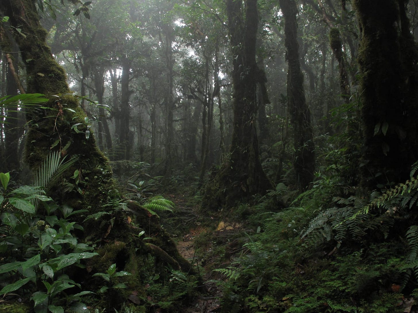
Today we’re talking about the Dayak; the term Dayak refers to over 200 different tribes scattered across a wide geography of the island of Borneo. These tribes have a wide spectrum of dialects and land management practices based on the varied terrain of the island, which, by the way, is the third largest in the world. For context, it’s roughly the size of Texas and hosts the oldest rainforests in the world. It’s also considered by researchers to be part of Zomia.
Zomia's history started in 1997 when anthropologist Jean Michaud tried to figure out a succinct way to categorize the diverse Southeast Asian region. With hundreds if not thousands of different languages, dozens of different religions, and an extensive range of social structures and customs, Southeast Asia is not just unique, but consistent in its uniqueness, which is where Zomia is born, originally being called Zomi.
Despite its overwhelming diversity, a dividing line can be discerned between those living in the 'highlands’ and those living in low-lying, flat areas. By looking at the various diverse human societies that populated the lands approximately 1000 feet above sea level in the southeastern portion of the Asian landmass, Michaud finds shared commonalities across a huge geographical region that extends beyond the conventional mainland Southeast Asian countries (Malaysia, Thailand, Laos, Cambodia, and Vietnam) and includes parts of Myanmar, China, Bangladesh, India, and even Taiwan. Those commonalities include a sense of marginalization, a lack of state subordination, and a vast ecosystem.
In 2002, Willem van Schendel proposed Zomia, derived from Zomi. Zomi is a common word in many Tibeto-Burman languages for Highlander and is used in several countries which form part of the Southeast Asian Massif. ‘Zomia’ thus captures both the diversity of this vast region overlapping 10 different countries and its key characteristic of high altitude peoples.
What we’re talking about here is focused on what’s considered to be the hilly, upland parts of the island of Borneo. One thing we’ve talked about quite a bit in these historical pieces is that traditional ecological knowledge is a direct response to economic and ecological conditions. Much of what we understand about Dayak agriculture is based on how it exists today, as very little documentation exists of practices that have sustained millions of people for thousands of years.
Now, the Dayak have historically and currently practice shifting cultivation or hill rice farming with long fallow periods, intensive agroforestry, and natural resource extraction. Shifting cultivation is a complex agricultural system dedicated to non-permanent shifting field use that is associated with fire for clearing land. The term often heard is Swidden, or shifting cultivation, which is predominant in tropical regions.
There’s one thing we have to understand about this region to contextualize their land management practices. Tropical soils in general have incredibly poor soils, which seems counterintuitive to the diversity of the rainforests themselves. That has to do with the mineral makeup of the soils, the temperatures, rainfall, and a bunch of stuff. The short of it is that the soils aren’t really good for traditional agriculture, so burning is a good way to quickly get nutrients available for new plants.
Now, swidden or shifting cultivation involves temporary cultivation of plots of land, which are then abandoned and allowed to revert to their natural vegetation while the cultivator moves on to another plot. This system can be maintained in the long term if it can adapt to and integrate with local conditions, and generally as long as there are other supplemental food systems in place as well. Most shifting cultivation systems blend agriculture with hunting, fishing, gathering, and resource-use systems in multi-niche strategies. Typically, shifting cultivators incorporate perennial crops such as fruit, medicinal, nut, and resin trees.
Traditionally speaking, a wooded area of roughly 1 acre is selected for cultivation; trees and shrubs are cut and the smaller material is burned to improve soil fertility. A so-called Ladang (swidden field) is planted with rice for 1 to 5 years, and rice is often intercropped with other annuals.1 When sufficient time has passed to restore fertility and reduce the weed population and agricultural pests, the field will be cleared and then reused for cultivation. It’s believed this practice has been in place for at least 6,000 years.
Before planting anything, the Dayak people employ certain criteria before taking something from nature. First, they must notify the customary head who has managed that land previously of their purpose. Second, several persons are assigned to look for a suitable forest plot. They will spend time in the forest to ‘receive instructions’ or ‘obtain signs’ from nature, while also providing offerings. In addition, the targeted forest area and its soils are carefully checked to establish whether it is suitable for cultivation or horticulture. Third, when the appropriate plot has been confirmed, an opening ceremony of the forest will be performed, as a sign of recognition that the forest gives life to them, and to ask for the blessing and protection of the forest.
The farming season begins in August or September at the end of the dry season with a cultivation season of six months. Before they begin to even farm, they mark the boundary of the plot intended for shifting cultivation by cutting trees. To prepare the site for rice cultivation, they clearcut the undergrowth so it can dry out before burning.2 The farmers then burn the grass and weeds on their existing plots or open new plots from forested areas. If a new plot is opened, the Dayak remove trees that are larger than 6 inches in diameter to use as fuelwood for cooking. This activity can be done by the owner and their families or together with owners of neighbouring areas.
From there, the ground is hand-tilled to remove the remaining roots and to loosen the soil. The rice is hand-planted at the end of September, usually within a week after the other practices are done. This rice is planted by dibbling.
Dibbling is a traditional method of planting rice. In humid, tropical climates, one of the biggest challenges around planting rice is due to the salinity of the topsoil from rains. While rice can grow if it’s just broadcast over a field, dibbling is the practice of planting the rice about an inch down into the soil to reduce its contact with the saline crust of these poor soils. During the dry season, which, if we think about when we’re burning– at the end of the dry season– the salts sit on the soil and slowly bake onto the crust, reducing the success of seeds growing on the surface.
Usually, neighbors work together for this and arrange their schedules so that all the neighbors can participate in the dibbling activities, and those same neighbors are also involved in harvesting the rice at the beginning of the dry season. Now, one of the other downsides of dibbling is heavier competition from weeds, so the plots are weeded continually throughout the entire year. They intercropped cassava, bananas, chili peppers, a spinach-like vegetable segau, lemongrass, sweet potatoes, and other perennial crops are planted when the rice is roughly knee height.
The planting method for these annual crops is called manugal. When starting a field, they plant different varieties of rice, and in every family that includes the superior, family-secret rice variety called upun binyi. People believe that they couldn’t share its name with anyone except family members because it would bring bad luck for their yields. In this practice, there were at least five different varieties of rice, depending on the size of the plot of land that had been cleared at that time. Moreover, people used traditional methods to eradicate pests in their fields, things such as flowers. If a bird came to the field to eat the rice, it would be fooled by seeing the yellow flowers, which looked like rice and would start eating the flowers instead of the rice.
To protect rice from, for example, brown planthoppers, a major pest for rice, they sprayed the rice with tobacco water or garlic water, similar to a KNF treatment. If there were mice that wanted to eat the rice, the first thing they would eat was the sweet potatoes. Alongside this, there was a sequence for planting types of rice: they’d plant those less desirable crops around the edges and as they got closer to the center of the field, the best rice varieties would be center and most protected from browsing.
With all of these crops, they could harvest for multiple years. Typically they would get around 3 years or so, but it was and is possible to harvest for up to five years. Additionally, just because the field goes fallow doesn’t mean it’s no longer of value. In fallow rice fields, intensive agroforests are often maintained to supply needed wood and food products. In many scenarios hill rice fallows are converted to agroforests permanently, or at least longer than the living memory of the people managing it exists
At the latest, that fifth year (bolah kuako), the soil is no longer fertile for rice, so forest succession begins. The first following stage goes by a few different names— we’ll use the easiest to pronounce, Urat — Forest succession after the rice harvest in March. At this time, arable land is already covered by some plant species, such as three different trees in the Macaranga genus and Trema orientalis, but their heights remain below three or so feet. T. orientalis is used as a medicinal plant, with young leaves that can be harvested like spinach and it’s also nitrogen-fixing. The others are primarily grown as early succession species which are good for charcoal and timber.
This brief succession phase is only 5 months, that is, between March harvest and August, after which the vegetation is cut down again. Following this stage is Urat mangur — Forest succession between 2 and 4 years. During this stage, those trees get bigger; up to 15 feet in a few years. This is followed by Urat pelega — Forest succession between 3 and 5 year after. You can see the overlap of time, based on climate and so on, but essentially these main trees get up to about 30 feet and start to bear fruit.
When these fields are no longer used for rice cultivation and start this process of reforestation they fall under the umbrella term of Uratn. Uratn provides much-needed resources for the communities, one of the most important being wood for the construction of field houses and firewood. Generally, the larger wood is used in construction while the smaller wood is for firewood. Edible and other species of bamboo and rattan shoots are often found in this stage along with residual fruit trees. Field houses generally need to be repaired annually or rebuilt if the family has opened up a new field.
The Dayak, unsurprisingly, spend most of their time managing these various sites, hence the field houses. Every family with a Umaq has a field house, and wood is regularly removed from the Uratn. We mentioned that there was bamboo, which is often used to build pens for livestock, floors for field houses, and altars for ceremonial purposes. Edible rattan shoots are another food source that is harvested from this space.
As these young trees mature and begin to get cleared for use, the understory is shooting up, and this stage is called Keloako, around 6 or so years in. The early succession remaining macarangas, as well as T. Orientalis, as well as the burflower tree, (which we don’t know a whole lot about), and a variety of Shorea genus trees, which are great for producing resins & Borneo tallow nuts. From there, the forest quickly continues to provide more species in the understory and the early stage succession hits its maximum size and species start dying off, having climbed up to 100 feet in some cases as little as 9 years.
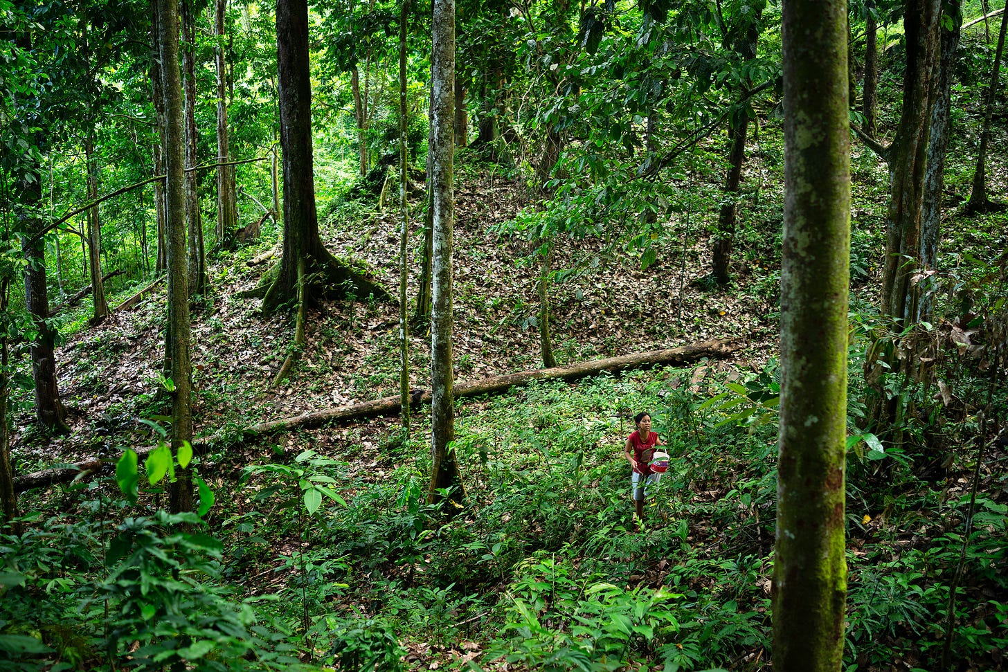
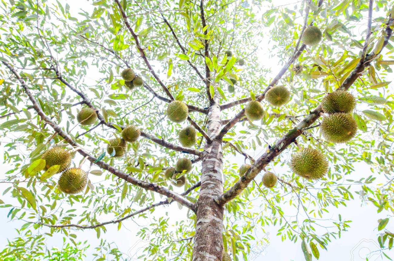
This period is called Batakng Pelega. The following stage, Hèma mangur, takes place over 20 years. The name Hema refers to primary forest, which indicates that some species from the existing primary forest have returned, and fruit tree species have begun to take over, including the infamous Dorian tree, as well as others that we don’t have good records to identify. Most of the trees listed in major research papers don’t even have common names; the only documentation available online is a couple of vague sentences.
My goal isn’t to bore people with facts but to showcase how the Dayak take advantage of each of these stages for specific utilities. So far, we’ve seen the annual agriculture production, wood production, greens, herbs, nuts, and fruit production, and now we’re seeing the natural cycle start to take over. The next successions, called Hema– host forests with an age up to 500 years. This forest is no longer managed by humans and is primarily for hunting. Shifting cultivation stages and forest succession periods can, in combination, amount to decades, if not centuries.
What we’re seeing is people identifying the best species that grow naturally in their area and helping them become the staples of the forest, as opposed to importing species that aren’t native and don’t necessarily help improve the diversity & resilience of the ecology. Their calendar for forest management is the rains, the winds, and the calls of the birds. January to April is fruit harvesting & tool repair time until the end of the rainy season. In May, boundaries are cut, and June the first trees of the season are felled as the ground dries enough so that the falling trees don’t compact the soil. July and August, as the winds kick up, is the burning season. The birdcalls of September signal the time to plant rice, and as the Lentokng bird makes its sounds, which is similar to throwing up, the end of rice planting has arrived, and it is time to start weeding.
So, while there’s a broad-stroke framework for how these forests are developed, certain areas, depending on several different things like soil type and so on, can be geared more towards fruits or resins. For example, Simpukng is considered to be primarily a fruit garden, consisting of jackfruits, langsat, kapor, durian, kaledang, coconut, lai, and sungkai. Kebotn are plots that are primarily geared around rattan and rubber. However, remember we’re talking about plots of land only a few acres in size, often directly next to familiar members in communities that are pretty much communal. Dayak along with other indigenous groups practice communal systems that sanction the sharing of land and resources which allows for a great amount of reciprocity between individuals in a community.
On top of all of these layers of farming and agroforestry, it’s common for these communities to maintain reserves that contain a surplus of natural resources. The Bengkar is the community forest reserve that provides wild game and forest resources such as additional rattan, wood, and medicinals. The communities’ reserves have had minimal timber extraction and are primarily used for hunting and small-scale extraction. The village head grants permission for resource extraction by community members. Fees are associated with the extraction of timber; non-timber forest products including flora and fauna are extracted at the discretion of community members.
The Modern Era
Today, the term Dayak has been coopted to be a generic term for the indigenous people of Borneo, which distinguishes them from the primarily coastal, Muslim Malays of Malaysia. While similarities exist, as we had discussed at the beginning of the episode, it’s a bit more nuanced.
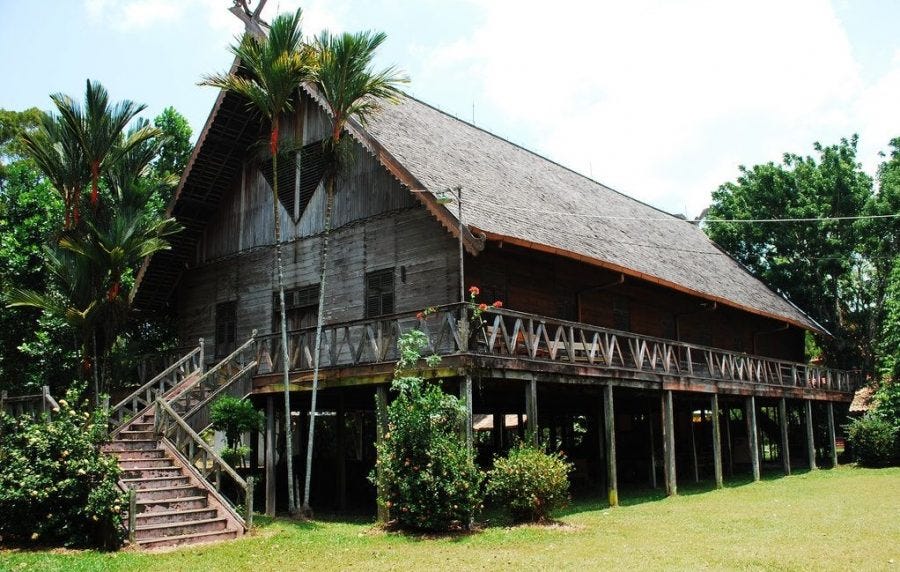
Historically, social organization was based around longhouse communities and subsistence-swidden agriculture.3 This method of housing supposedly protected from warring ethnic groups, although I’m suspicious of this claim. The longhouse is the traditional Dayak communal home where several families live in one large housing unit sharing a common roof. Many traditional longhouses housed 200 or more families and were hundreds of feet long. The houses are elevated off the ground and are built with a large communal veranda with individual and multiple-family homes sharing common walls. Multiple families will live within one “unit” within the longhouse. If an additional “home” is needed then it is built onto the end of the longhouse. Some longhouses can extend in many directions and develop into a maze, expanding to accommodate the growing community.
Now unfortunately this lifestyle has continued to be challenged, specifically where we’re focusing on, in Indonesia. Indonesia has 15,000 islands and about 6,000 are inhabited. There are over 300 distinct ethnic groups and at least 365 recognized local languages living in the country. Over 10 million indigenous people continue to live mostly within the forested areas of Borneo, as well as a handful of other islands.
In Indonesia from the 1980s onward, deforestation has been estimated at 4 million acres annually.4 The national forest policy of Indonesia has set a threshold of around 880 million cubic feet of timber harvesting to be sustainable, but haven’t held themselves to that standard.5 By the 1990s, they consumed around 2.8 million cubic feet, well over double the threshold.6 After sites were cleared and logging roads were put in, plantation forests replaced natural succession with the idea that it would aid in ‘sustainable forestry’ by reducing and cutting down native forests. Exotic fast-growing species were brought in, which often have health issues and drain the nutrients from the soil.
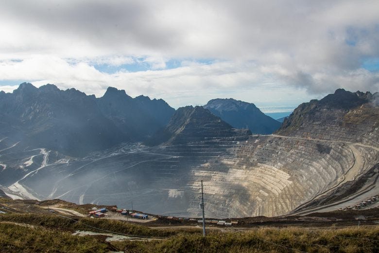
Unsurprisingly, land degradation takes hold quickly. This isn’t the only problem endangering native people; mining is also causing major ecological destruction. Coal, gold, and other mining cause massive environmental degradation in East Kalimantan, but it has also been the main source of income for the government in the region. Specifically, PT Kelian Equatorial Mining, one of the largest gold mines in the world is located in Kutai Barat, East Kalimantan. (The mine is 90 percent owned by Rio Tinto Foundation of Australia and 10 percent owned by PT Harita Jayaraya of Indonesia). 7 Not only do they mine massive amounts of gold and silver, but they process those minerals, leading to cyanide leaching, which causes significant environmental damage. For each ton of ore extracted, five tons of tailings, or the leftover byproducts of these processes, are produced.
With climate change and the failures of forest plantations, countries are more often turning to traditional ecological knowledge, also known as TEK, to find solutions to deal with ecological destruction. What’s left to be shown is whether or not this will be lip service or if it leads to any meaningful change.
If you’ve enjoyed this piece, which is equal to a 13-page chapter, of (so far) a 1079-page book with 725 sources, you can support our work in a number of ways. The first is by sharing this article with folks you think would find it interesting. Second, you can listen to the audio version of this article in episode #210, of the Poor Proles Almanac wherever you get your podcasts. If you’d like to financially support the project, and get exclusive access to our limited paywalled content, you can become a paid subscriber on Substack or Patreon, which will both give you access to the paywalled content and in the case of Patreon, early access to the audio episodes as well.
Crevello, S. (2004). Dayak Land Use Systems and Indigenous Knowledge. Journal of Human Ecology, 16(1), 69–73. doi:10.1080/09709274.2004.11905718
Siahaya, M. E., Hutauruk, T. R., Aponno, H. S. E. S., Hatulesila, J. W., & Mardhanie, A. B. (2016). Traditional ecological knowledge on shifting cultivation and forest management in East Borneo, Indonesia. International Journal of Biodiversity Science, Ecosystem Services & Management, 12(1-2), 14–23. doi:10.1080/21513732.2016.1169559
Local land use on Borneo: applications of indigenous knowledge systems and natural resource utilization among the Benuaq Dayak of Kalimantan, Indonesia
https://www.globalforestwatch.org/dashboards/country/IDN/
Local land use on Borneo: applications of indigenous knowledge systems and natural resource utilization among the Benuaq Dayak of Kalimantan, Indonesia Stacy Marie Crevello
https://documents1.worldbank.org/curated/ru/714851468294107526/pdf/317820PH0rev0P1ank0Infra1401PUBLIC1.pdf
https://www.forestpeoples.org/sites/fpp/files/publication/2010/08/eirinternatwshopindonesiacaseengapr03.pdf


