Balancing Tradition and Modernity: Agroforestry in India's Western Ghats
India's unique land management history on its steepest slopes
Here in the United States, the image of India today falls into two buckets— the massive megacities that house a not insignificant portion of the world’s population and the dusty, rural communities built on labor-intensive farming and livestock herding. While these are reflections of the reality of many parts of the nation, today we will explore the tropical, southern mountains of the nation— the Western Ghats.
The agroforestry in the Western Ghats, similar to Satoyama in rural Japan, is a traditional land-use system with similar evolutionary trajectories. Some of their prominence was lost by the middle of the twentieth century when modern agricultural technologies and urbanization engineered shifts in emphasis toward maximizing crop production. There has been, however, a resurgence of interest in traditional land-use systems recently, given their ability to provide ecosystem services. Both agroforestry and satoyama are recognized for their biological diversity and have the potential to also serve as ‘‘carbon forests.’’
The Western Ghats (WG) of India and the satoyama landscapes in Japan are geographically diverse regions, and they both exist as the opposite of Norway in terms of climate. Yet, there are remarkable similarities in these territories' traditional land-use practices and physiographic features. A series of rolling hills and plateaus intersected by deep valleys have been managed similarly in both of these warm climates. For both, rice forms the predominant crop in the lowlands and often terraced plateaus, bordered by homesteads and various forms of managed woodlands. Forests occur on the upper reaches of these land-use patterns and provide many goods and services. Managed ecosystems have long existed in equilibrium with the natural landscape at both locations.
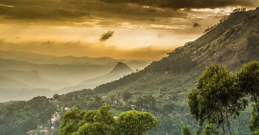
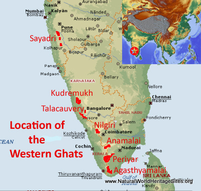
The biogeographic region of the Western Ghats is the mountain range running along the western margin of the Deccan Plateau in peninsular India. The term ‘Ghats’ implies the terraced appearance of the mountains, and the steps of the terrace are indicative of successive lava flows, which were also crucial in the Satoyama landscape. Steep-sided valleys, narrow gorges, and waterfalls are distinctive features of this landscape. The steep seaward slopes are deeply cut by rivers and streams, and there are numerous canyon-like valleys. The continent-facing slopes are, however, more gentle, with wide valleys and rolling topography. Rich natural resources in terms of vegetation, fish, animals, and soil make this region a mega-biodiverse region, home to more unknown species outside of the rainforests than anywhere on earth.1
When we had discussed the satoyama woodlands and the role of things like coppicing for products, it was clear by the collapse of diversity after the farming practices were abandoned that the woodlands themselves were extensively managed; however, less thought was given to the understory outside of grasses while agroforestry in the Western Ghats involves key productive and protective functions, and adopts ‘intensive management’ in limited ways. We can look at differences in canopy architecture (multi-tiered structure of agroforestry vs. the more or less unitary canopy of satoyama) and land ownership pattern (privately owned/managed agroforestry holdings vs. community or local government or privately owned and mostly abandoned satoyamas) which pose other challenges in the transfer and application of knowledge gained in one system to the other.2 For folks that don’t recall from previous pieces where we wrote a bit about agroforestry— we often see layers of trees within the canopy, as well as ground cover and sometimes even bushes and vines, each with specific functions for either the environment or for us as consumers.
Much like the Satoyama landscape, the hill slopes were largely covered by natural or managed woodlands and terraced paddy fields— serving as sources of food, fuel, and timber, besides providing an array of ecosystem service benefits. To illustrate this point further: the traditional farmers of the Western Ghats typically maintained three land parcels, situated at different altitudinal zones within a micro watershed—the low-lying paddy fields providing a significant part of the food and feed requirements, the ‘garden land homestead’ situated close to the paddy fields and sustaining a mixed plant/tree crop system, and the upland plot with mixed tree cover including forest trees for meeting the grazing, organic manure, and soil conservation needs.
The ‘‘nutrient subsidies’’ from woodlands, that is, if you recall, the removal of various biomass from the woods to build soil in the intensive gardening areas, a tactic presumably common to all forest-margin areas, helped both the traditional Western Ghats and Japanese farmers to maintain soil fertility and productivity. In particular, the unidirectional flow of materials, such as leaves/litter for manure and mulch, fruits and nuts for food, green fodder and wood for fuel, poles, timber, and various other nontimber products, with essentially no reverse flows, helped to keep the landscape rich, and helped the small farmers with limited access to chemical fertilizers.3 The indigenous farmers also used ‘traditional ecological knowledge’ to manure crop plants and trees. For example, the Western Ghats farmers integrated the shade-tolerant crop species in the understory; a case in point is the tropical home gardens. Maximization of productivity was never targeted or attained, and hence industrial crop production techniques were seldom employed in the home gardens.
Returning back to the home gardens, the sacred groves and sacred landscapes of the Western Ghats, however, are a prominent feature of the mythological landscape there. Apart from being repositories of rare and endemic species, these are remnants of primary forests left untouched by the local inhabitants and protected by religious beliefs and customs. Not only are they full of unique species, but they are still able to supplement food systems and additionally exist with human interaction, something we traditionally don’t assign to landscapes with these types of old-growth forests. 4 These communities have quite literally centered their lifestyle around ecology, making what you might call the soul of nature the location of our domestication.
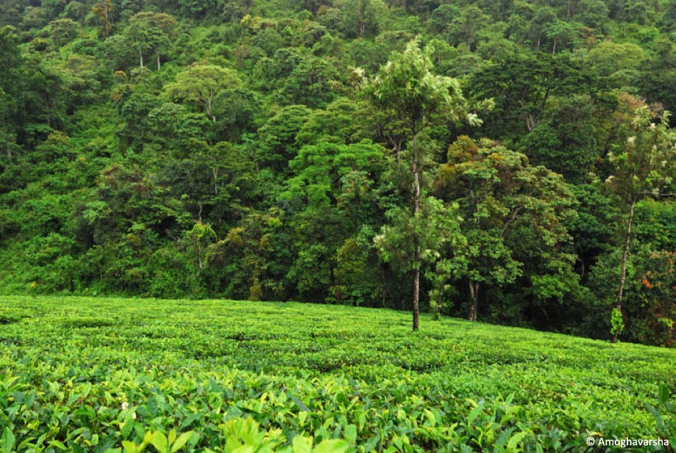
Agroforestry systems where trees are grown with crops, and/or sometimes with animals, in interacting combinations in space or time dimensions, abound in the Western Ghats. In particular, plantation agriculture involving coffee, tea, and spices in association with a wide spectrum of trees, rice-based cropping systems, coconut-based cropping systems, and the all-pervasive homestead farming systems dominate the region. Historically, plough agriculture was prevalent in Wayanad, one of the high-altitude locations in WG, as early as in the Megalithic Age, between 400 BCE and 400 CE, and spices like pepper, ginger, and cardamom have been grown there since the early Middle Ages.
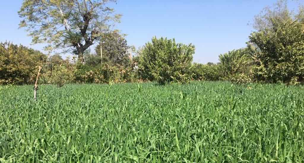
I also found one town who provided a specific example of what this looks like in modern times. The Banswara village landscape is differentiated into three land use-land cover types: settled farming on privately owned terraced slopes with scattered multipurpose trees, degraded community forest land and degraded abandoned agricultural land. Degraded lands have negligible tree cover and were exposed to uncontrolled grazing. The village is surrounded by government forests. Though two sets of crops, one growing in the warm rainy season and the other in the cold winter season, could be harvested in a year, a farm field is fallow during the winter season once in two years, meaning that three crops are harvested over a period of two years. Fingermillet, barnyard millet and paddy are the dominant crops of the rainy season and wheat, lentil, and rape seed of the winter season. Each family has at least a pair of cows and bulls. Leaf litter from the forests is used as bedding material in the cattle shed. The litter mixed with cattle dung is used as manure in the crop fields. Cattle feed is met partly from crop by-products and tree fodder from the private farms and partly from grazing and lopping of fodder trees in the community and government forests.
Tree planting has formed a component of land rehabilitation strategy built on indigenous knowledge, local needs and people’s participation. The species selected for plantation were chosen by the village community from a wider list of traditionally valued and naturally regenerating tree species.
Environmental and agro-ecological functions of trees (soil protection, water control, soil fertility maintenance, conservation of biodiversity, etc.), as well as their various functions of production (wood, food, fodder, medicines, etc.), are centered in agroforestry systems derived from forests, such as the coffee based-system of the Coorg District, Karnataka, or imitating them, such as the home gardens of Kerala, in the western ghats.
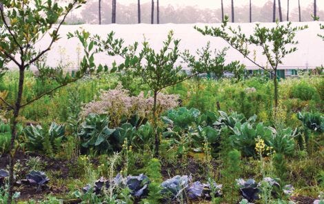
The home gardens of Kerala constitute the predominant farming systems of the state. They are small in size, just around 1 acre, and traditionally coconut-based, being widely used for food, energy and building materials. Home gardens are typically multi-strata systems characterized by a high density and diversity of the tree component. Density is commonly found between 150 to 300 trees, shrubs and palms per acre and the number of species is more than 120 according to various surveys, although floristic composition and density may vary significantly at plot level according to site conditions and farmers’ needs and strategies.5
Home garden systems also record high total canopy coverage. Accordingly, soil erosion levels are remarkably low, given the high rainfall and steep slopes of the medium altitude environment of these home gardens. Interestingly, when comparing successive developmental stages of land use systems based on forest clearing—which is still a common practice in the forests of India, be they protected or not— organic matter appears to rebuild to high and sustainable levels in well established agroforestry systems and more efficiently than in other ones, thanks to the capacity of trees to build soil fertility. The other main characteristic of the home gardens is their high productivity and diversity of production to satisfy the primary needs of the farmers: food (with the exception of rice which is cultivated in adjacent valleys), fuel, timber and cash.
According to various surveys and apart from the coconut, the dominant woody perennial crops include: arecanut, the betel-nut used as a masticatory, black pepper (Kerala being the first producer in the world, thanks to its home gardens), the rubber tree, the cashew nut, the jackfruit and its wild variety used as a valuable timber, fruit trees, mango and tamarind, many other wood species such as teak, Ailanthus triphysa, a commercial soft wood used in the match industry, and legume trees like Erythrina indica, a fast-growing species commonly used to trail and shade pepper vines and maintain soil fertility.6 According to one study, the home gardens of Kerala provide some 80% of the total wood requirements of the state, mostly its firewood, while timber is supplemented by imports. Therefore, home gardens appear to be an appropriate way to reduce pressure on natural forests and contribute to the environmental balance of this fragile mountain area.
Tree uses may also vary with time and accordingly, traditional agroforestry systems, like any other system, are indeed subject to adaptation or disappearance. Demographic and economic conditions may notably induce drastic changes in the livelihood of rural communities and directly affect agroforestry systems and landscapes. This is the case for shifting cultivation, a once common cropping system of semi-nomadic population in the tropical forest zone. In the mountains of north-east India, the system locally called “jhum” by tribals is based on slashing and burning of the natural vegetation which, after a short period of cultivation, is allowed to re-grow for thirty to sixty years in its longest cycle. But under demographic pressure, the cycle has been shortened from 2 to 3 years, which provides insufficient slash material and has meant change to sedentary systems of agriculture at the expense of forest and soil sustainability.
While North India comes with its own unique climate and challenges, burning as a practice was applied on and off throughout the past 4,000 years of history in the Western Ghats, although it hasn’t held a meaningful part of the forest management system for the past few hundred years. The agroforestry landscape switches between periods of no fires from 2000 bc to 200 AD and 600-1600 AD, and fires 200-600 AD, and 1600-1950s, with both fire periods concomitant with intervals of enhanced aridity.7 There’s evidence of impacts by anthropogenic fires and aridity on plant diversity uneven across time, pointing towards varied land management strategies implemented by the contemporary societies. For example, during 150-450 AD, diversity reduced in conjunction with a significant decrease in the canopy cover related to sustained use of fires, possibly linked to large-scale intensification of agriculture. In contrast, the substantially reduced fires during 1550- present may be associated with the emergence of sacred forest groves, a cultural practice supporting the maintenance of plant diversity.
Now what makes India particularly interesting is the fact that such varied practices have taken places across southern India, where some regions have developed unique agroforestry systems designed around rice paddies, while other areas have relied predominantly on these burning practices. All of these systems have ebbed and flowed throughout the region as feedback loops have proven over the long-term the sustainability of each of these systems, and shows that there are often multiple ways to manage similar landscapes, even similar landscapes with very similar ecosystems. That said, India has some of the most complex and diverse ecosystems in the world, where numerous biomes exist in tight quarters, all of which are reinforced by the longstanding human intervention that marks the past 10,000 years of the regions history.
The fact is that, much like the Dayak, one of the world’s most diverse regions had once experienced these burns suggests that tropical diversity is enhanced by these practices, but little empirical evidence exists at this point. While human-made fires have existed over time, fires in these forests rarely occur naturally because, first, there is a very low coincidence of lightning with climate conditions suitable to carry fire, and secondly, even if a fire is initiated, the high fuel moisture in these rainforest ecosystems generally prevents propagation.
While these practices have mostly been set aside outside of very small, localized fires, natural fires have begun to take ahold in the region again. This intensification of fires is particularly alarming in light of the projected weakening of the Indian Summer Monsoon, which is expected to exacerbate rainfall extremities in the Indian Subcontinent, extending the length of hot-dry months. Such enhanced regional aridity could mean drier fuel loads, resulting in more frequent spread of fires beyond agricultural lands. By developing a historical perspective, we can think about region-specific management information for biodiversity conservation in the Western Ghats and wet tropical agroforestry landscapes at large, by looking to how these lands have been managed in the past, and likely during periods of similar droughts which can guide our management of these landscapes to maintain biological diversity.
It’s important to note that human interaction with the landscape in India is much more ancient than most of the world, with evidence of human intervention on the landscape existing for more than 80,000 years.
Evidence points to the fact that fire management was applied during periods of dryness over a long period of time, hundreds of years often times. Over 4,000 years, plant diversity changes lag behind fires by as many as 250-500 years, but after each dry spell with intensive fire management, during which plant diversity falls, diversity jumps to higher levels than before the dry spell. Amid the first fire period, nearly 2,000 years ago, the plant diversity substantially decreased around the year 500. Considering the strong positive correlation between the canopy cover and the plant diversity, in the sense that forests tend to help maintain stasis in terms of regulating ground temperature and moisture levels, it’s easily possible that the sustained biomass burning coupled with enhanced aridity could have resulted in landscape fragmentation and a consequent reduction of plant diversity. By opening and increasing canopy gaps and creating snags and deadwood patches, the prolonged use of fire can increase the number of potential ecological niches for when the fires are no longer utilized.
This evolving, complex relationship with the landscape was first punctured by the colonization of India by the British 300 years ago, which brought with them western European understandings of land management and timber production, which banned the practice of slash and burn and forced massive mono-crop stands; first for timber and later for coffee.
Fortunately, we now have the tools to trace the history of the landscape, much like in previous episodes, most data on the history of this landscape comes from charcoal and pollen records, which help researchers trace rainfall, burning practices, species diversity, and density, and human habitation on the landscape. And, of course, with increased interest in TEK & land back, more honest conversations of what stewardship should look like and what it means to give full sovereignty of these lands to their caretakers means that restoration by communities with shared ancestral knowledge can take place. With this knowledge, we can look to our past to help guide our decisions to find ways to take on the unprecedented challenges climate change brings to our landscape today.
If you’ve enjoyed this piece, which is equal to a 13-page chapter, of (so far) a 1282-page book with 914 sources, you can support our work in several ways. The first is by sharing this article with folks you think would find it interesting. Second, you can listen to the audio version of this article in episode #30 of the Poor Proles Almanac wherever you get your podcasts. If you’d like to financially support the project, and get exclusive access to our limited paywalled content, you can become a paid subscriber on Substack or Patreon, which will both give you access to the paywalled content and in the case of Patreon, early access to the audio episodes as well.
Kumar, B. M., & Takeuchi, K. (2009). Agroforestry in the Western Ghats of peninsular India and the Satoyama Landscapes of japan: A comparison of two sustainable land use systems. Sustainability Science, 4(2), 215–232. https://doi.org/10.1007/s11625-009-0086-0
Maikhuri, R.K., Semwal, R.L., Rao, K.S. et al. Growth and ecological impacts of traditional agroforestry tree species in Central Himalaya, India. Agroforestry Systems 48, 257–271 (2000). https://doi.org/10.1023/A:1006344812127
Viswanath, S. (2022). Traditional agroforestry systems and practices of Assam. Indian Journal of Traditional Knowledge, 21(2). https://doi.org/10.56042/ijtk.v21i2.31569
Maikhuri, R. K., Semwal, R. L., Rao, K. S., Singh, K., & Saxena, K. G. (2012). Growth and ecological impacts of traditional agroforestry tree species in Central Himalaya, India. Agroforestry Systems, 48(3), 257–271. https://doi.org/10.1023/a:1006344812127
Depommier, Denis. (2003). The tree behind the forest: Ecological and economic importance of traditional agroforestry systems and multiple uses of trees in India. DEPOMMIER 63 Tropical Ecology. 44. 63-71.
Viswanath, S., Nair, P. K., Kaushik, P. K., & Prakasam, U. (2000). Acacia nilotica trees in rice fields: A traditional agroforestry system in central India. Agroforestry Systems, 50(2), 157–177. https://doi.org/10.1023/a:1006486912126
Kulkarni, C., Finsinger, W., Anand, P., Nogué, S., & Bhagwat, S. A. (2021). Synergistic impacts of anthropogenic fires and aridity on plant diversity in the Western Ghats: Implications for management of ancient social-ecological systems. Journal of Environmental Management, 283, 111957. https://doi.org/10.1016/j.jenvman.2021.111957

